Tuesday, June 26, 2012

Day 9: Moab, UT to Vail, CO

Forgoing breakfast, we packed up and headed out early. I ran to the store and got some essentials and breakfast for all of us while Greeg and the kids washed the motorhome. We hitched up and headed out of town. We took Highway 128 which travels along the Colorado River -- it’s so beautiful. (So beautiful, in fact, that I forgot to take any pictures!) Eventually, though, it took us back to Highway 70 -- still with pretty unappealing desert scenes.
Not a pretty desert
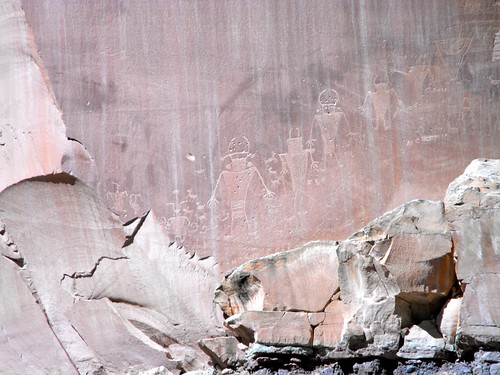
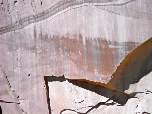
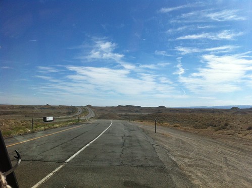
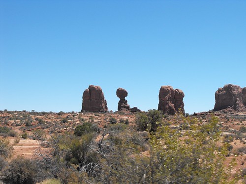
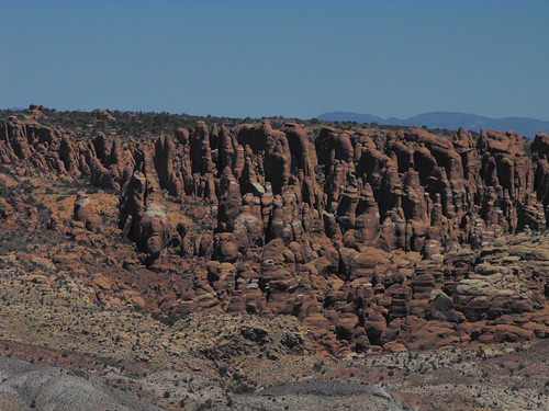
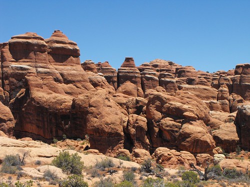
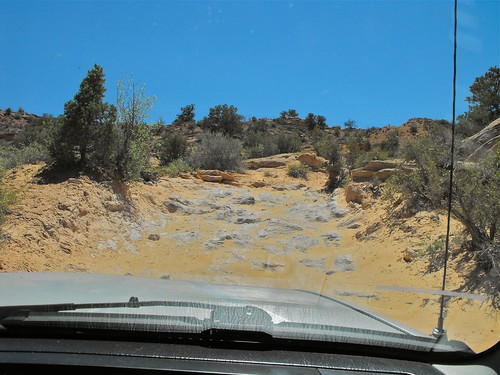
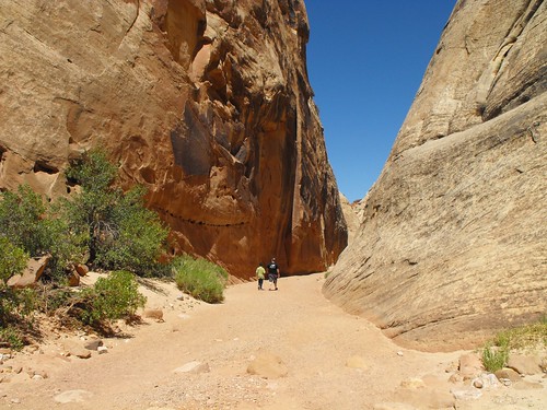
Stark, barren desert -- hard to believe the Colorado River is less than 10 miles away.
 Almost immediately upon entering Colorado, the scenery got better. We even saw a Golden Eagle on a light pole along the freeway.
Gorgeous road along Colorado River
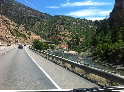
Love driving along the Colorado river . . . it's so beautiful!
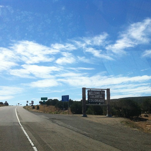
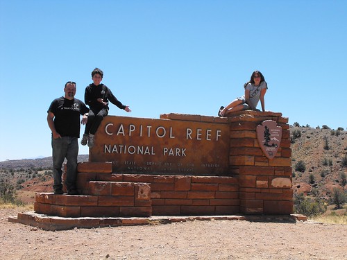
 
Welcome to Colorful Colorado
Colorado!  State #4
We stopped for lunch in Glenwood Springs, CO at the No Name Rest Stop (really - that’s what it’s called!).
We had lunch at the No Name rest stop
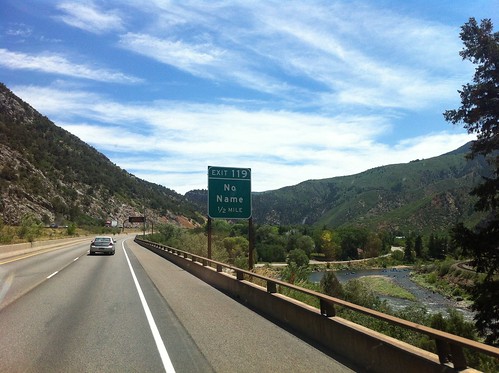
No Name?  I'm sure I could have come up with 50 different names if asked!
We had a good, long climb into Vail and our plan was to spend the night at a forest service campground just north of Vail so I took my car and zipped up the mountain while Greg and the kids followed at a more reasonable pace behind. I found the campground, staked out a site, and texted Greg the particulars. He was there within 15 minutes. We are in another Aspen campsite with flowers all around.


After some naps and relaxation, we decided to take a drive into Leadville - it’s only 35 miles away but it’s at 10,152 feet. We had a beautiful drive up there -- even saw a beaver dam along the way. Leadville is a really neat little town with a rich history. We had a great dinner at the Quincy restaurant. We had prime rib (yum!) with baked potatoes and salad. We walked around downtown a little and had ice cream for desert. Taking even a short walk at that altitude is exhausting . . . You find yourself huffing and puffing as if you had been jogging around town. We talked about when Greg and his family stayed there years ago in their Winnebago and had been buzzed by giant mosquitos that flew in formation like Air Force jets. We didn’t see a single mosquito in Leadville.  Could they have been exaggerating about the giant bugs all these years? 


Leadville, CO
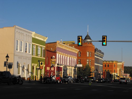
Leadville is absolutely charming!


Fearnley Bldg, Leadville, CO
More of beautiful Leadville, CO 
HUGE mine outside of Leadville
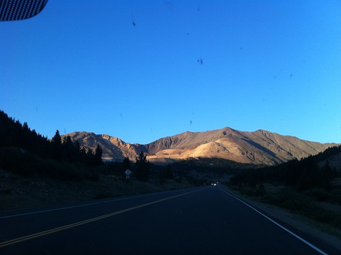
The mine is over 11,000 feet -- just before the pass.
 And then we headed back to Vail -- taking a different route over another pass (11,318 feet!!!) past an enormous mining operation, and near some lovely little lakes.


As we passed the lakes, we were suddenly in a swarm of large moths, there was no way to avoid hitting them and the carnage was severe. We couldn’t see well through the windshield so we turned on the squirters and wipers to clear off the debris . . . No luck. It just smeared. Greg drove by braille to the roadside and we got a big brush we had in my car and some washer fluid and tried to clean the windshield again. As you can see, it was no easy job. I love Gage’s reaction to the rest of the car . . . Moths were everywhere . . .in the bikes, all over the front, in the radiator. Nightmarish . . . And think about how the poor moths felt.
Untitled
Well, that didn't work!

Untitled
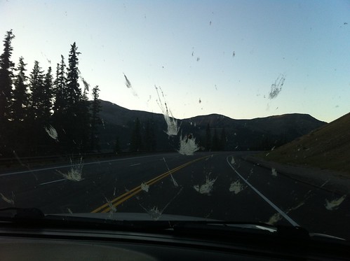
Suddenly we hit a swarm of moths . . . 


Untitled
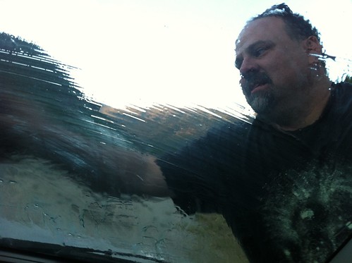
Not a fun job!  My hero!


Untitled
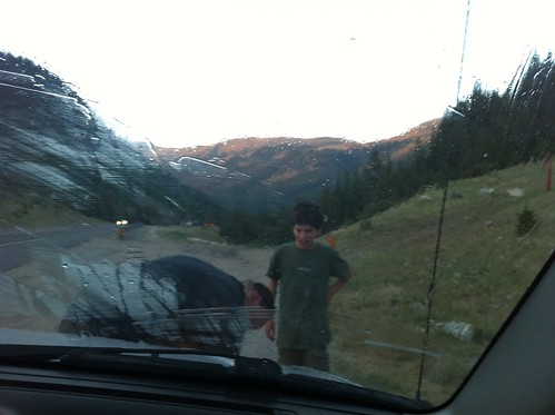
Don't you love the look on Gage's face?

We returned to the FMC without further incident and tucked in . . . Ready to tackle another drive and another park tomorrow as we go to Rocky Mountain National Park!
Campsite at Vail, CO
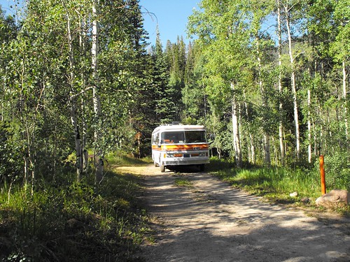
Our campsite at Vail, CO

Day 8: Arches National Park

Untitled
The Millers at Arches 
Arches
The rock formations are amazing to see.
Untitled
Tons of arches and balanced rocks.
Untitled
To go in this area, you need a hiking permit -- I'm guessing it's in case you get lost.  The rangers will know where to look for you!
Balanced Rock
The famous Balanced Rock
Moab is the gateway to two National Parks -- Arches and Canyonlands. We only had time to see one of them so we headed into Arches in the morning. Arches is truly a beautiful park, filled with natural wonders, however . . . It is also FILLED with people. The first stops we made were cram-packed with people, including several busloads of tourists from Asia. We hiked en-mass to see the North and South Windows. They were beautiful and amazing but it was so crowded. After spending the day at the quiet, peaceful Capitol Reef, we had a hard time adjusting to so many people.
North Window
The North Window
Untitled
Gage wanted some alone time at the Windows.
Untitled
As you can see, that's difficult to manage here.  Inadvertent photobomb!
Untitled
Greg and Ruth climbed up high to see what they could see.  So did a lot of other people.

Untitled
Ruth will always find a high spot -- makes my heart beat faster.
Untitled
Just to give you a little perspective!
 Thankfully, the deeper we went into the park, the fewer crowds there were. The weather was very hot (100F) and the two short hikes we did were really enough for us. The first one was to see the Windows and the second was straight uphill to see Delicate Arch. We had hoped to hike out to Landscape Arch but just didn't have the energy for it in the heat.
Untitled
Love seeing the layers of rock.
Untitled
Another arch with people.
Skyline Arch
Skyline Arch
So, we decided to take a dirt road to a 4x4 road -- just to get out and get the car dusty. The dirt road was very washboard and not a lot of fun to drive on -- although, the scenery was lovely and we had it pretty much to ourselves. The 4x4 road was really nice -- no washboard and just some soft sand that was no problem at all -- until we got to a small ridge. The road got incrediably rough and we decided it was too much for my Suzuki -- it’s a tough little car and has done some amazing roads but being stranded 5 miles down a dirt road in 100F heat didn’t seem like a good plan . . . So, back down the washboard road we headed.

Jeepin'
Here was some of the soft sand on the 4x4 road.

Uhm, nevermind!
It's a little bit hard to tell but that road goes straight up and there are big holes around the rocks in the road.
Dark Angel Rock
The Dark Angel tower . . . Gage dubbed it The Evil Red Wizard's Tower!
Arches
Beautiful, stark country
La Sal Mountains in distance
Washboard road, looking toward the La Sal mountains (all over 12,000 ft)
We washed my car on the way back to the campsite and made plans to wash the FMC on our way out of town in the morning.

Monday, June 25, 2012

Day 7: Oak Creek Campground to Moab, Utah

We woke up, had breakfast and headed down the road . . . Back into the desert.  We made an unplanned stop at a store called The Flute Shop outside of Torrey, UT.  It was a great stop for the kids.  Gage got a knife and Ruth got a beautiful wooden flute made by the owner of the store.  

Untitled
A great stop in Torrey, UT
Our route to Moab took us through Capitol Reef National Park.  We’d never been there but had heard good things about the park.  And, boy were they right.  It’s a really unusual park - both the natural beauty and the history are very important.  The Fremont River formed this amazing canyon, leaving lush fertile soil at the bottom.  Mormon pioneers moved into the area and created a very small community that they called Fruita.  There were families living in the area until the mid-1950’s.  There are orchards everywhere and the heritage society raises money by canning produce grown in the park and making pies from the fruit.  We had some blackberry pie after our lunch and then took a hike up a dry river bed and while the footing was easier (sand instead of boulders), there is something to be said for hiking in a river . . . It’s much cooler than hiking in a dry wash.  
The goal of the hike was to see some Fremont indian petroglyphs and a pioneer register where people passing by on their way through the region would write their names and the date on the sandstone walls of the canyon.  Sadly, there has been a lot of graffiti at the site so some of the names were hard to read because of the other writing on top of it but it was fascinating walking through there and imagining their journey.  
Untitled
Capitol Reef National Park -- a new favorite!
Untitled
Dramatic cliffs at Capitol Reef NP

Untitled
At the end of the drive, we got ready to hike.
Untitled
Hiking up another slot canyon . . . this one was dry!
Untitled
Can you imagine how much water this can hold in a flash flood?
Untitled
Hiking up the slot canyon . . . hot and dry!
Untitled
That rock dangles over the road!  Yikes!
Gage learned the joys of photobombing
Gage discovers the joys of photobombing his mother . . . oh happy day!
Untitled
Pictographs at Capitol Reef NP
Untitled
A sun symbol

Untitled
Local residents carved this about 50' up the cliff face

Untitled
Looking up at the list of names
Untitled
Gravel bottom . . . easier hiking than the boulders in The Narrows
Untitled
The orchards are green and lush.  There was a sign that said, "Don't feed the deer!"


Untitled
It is a beautiful park.
Untitled
The geology at Capitol Reef is fascinating and readily seen throughout the park.
Untitled
Fremont Indian symbols on the way out of Capitol Reef
Untitled
Love the Big Horn Sheep image

When we were done, we headed on our way to Moab, seeing more beauty in Capitol Reef on our way out.  (We would definitely go back and spend more time there!)  The desert along Highway 70 in eastern Utah is drab and boring.  We thought about stopping at Green River, UT but it seems to be a dying town and we decided to push on to Moab.  
Once you turn off 70, the terrain gets much more interesting and we were glad we made that choice.  We ended up staying at a private campground south of Moab.  We had a great dinner in Moab at The Blu Pig -- a bbq and blues resturant.  Delish!  The showers that night felt SO good and I got our week’s worth of laundry done!